urAnimalControl

Nobody should need to know whose job it is.

A resident with a loose dog, an injured cat or a welfare concern should be able to say what they saw and have it reach whoever is actually responsible. Officers get the field side of the same record.

One report. One accountable journey.

Follow a fictional demonstration from the public form through dispatch, field work, identity review and supervisor-governed records. These are live mobile screens from the working demo sandbox.

Demonstration only — every person, address, animal and case shown below is fictional.

  1. Step 01

    A resident reports what they observed

    No account is required. The form separates observation from conclusions and makes the reporting choice explicit.
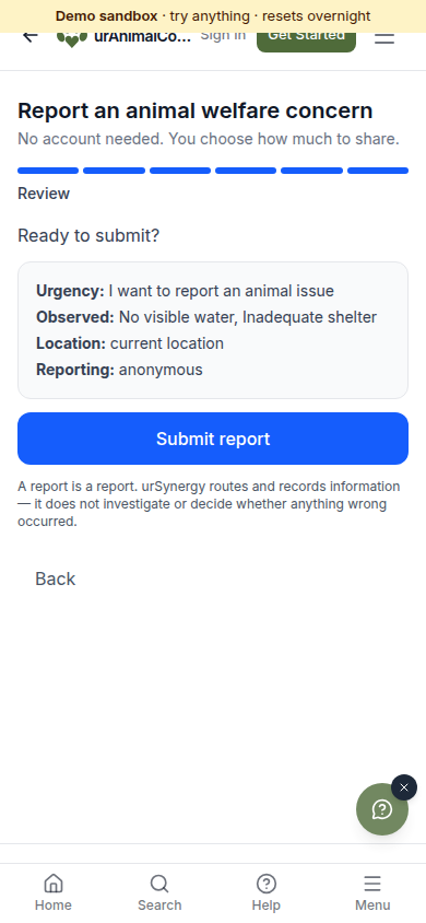
    Mobile review screen for an anonymous animal welfare report with observed conditions and location.
    Live mobile workflow · fictional demonstration data
  2. Step 02

    The report becomes an agency call

    The original words, routed authority, fictional location and public reference stay together for dispatch.
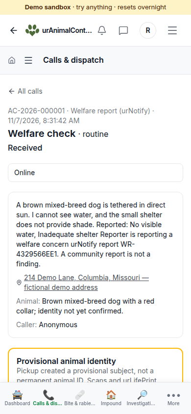
    Animal-control dispatch call on a phone showing the public report and a provisional animal identity.
    Live mobile workflow · fictional demonstration data
  3. Step 03

    Field work continues offline

    An officer can queue an update on the device and synchronize it when the connection returns.
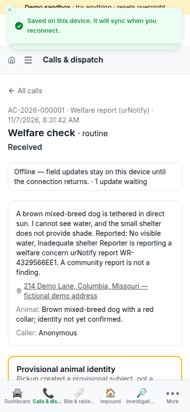
    Animal-control call showing offline mode and one field update waiting to synchronize.
    Live mobile workflow · fictional demonstration data
  4. Step 04

    Identity remains a human decision

    Microchip and urLifePrint candidates are suggestions. No scan or model result silently creates a permanent identity.
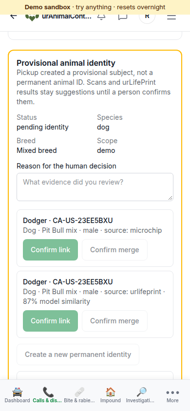
    Provisional animal identity screen with microchip and urLifePrint candidates awaiting human confirmation.
    Live mobile workflow · fictional demonstration data
  5. Step 05

    A supervisor records the determination

    The allegation, direct observation, rationale and human decision remain distinct and reviewable.
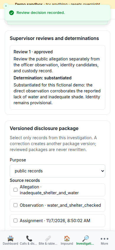
    Supervisor review showing a substantiated determination and its written rationale.
    Live mobile workflow · fictional demonstration data
  6. Step 06

    Disclosure and preservation are governed

    A versioned disclosure package records redactions, while a legal hold preserves the underlying demo records.
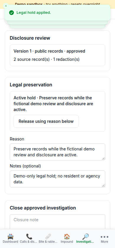
    Investigation screen showing an approved public-records disclosure package and an active legal hold.
    Live mobile workflow · fictional demonstration data

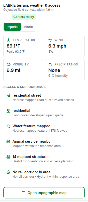
Field context that reads like a report

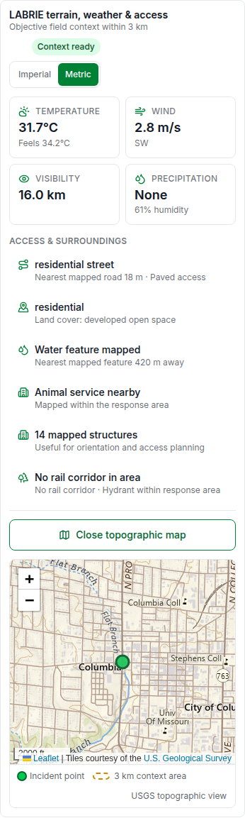
LABRIE turns terrain, weather, access and nearby features into an officer-readable snapshot, with an interactive USGS topographic view when the map matters.

Your units, by default

Metric or imperial follows the signed-in user's measurement setting. The on-report switch updates temperatures, wind, visibility, precipitation, distances, response radius and map scale together.

A topographic response view

Authorized staff can open the incident point and its context radius on a USGS topographic map without exposing that exact location on the public report.

Context preserved with the incident

The incident keeps the jurisdiction snapshot and the LABRIE context that informed the response, rather than silently replacing it with whatever the map or weather says later.
LABRIE mobile summary in imperial units with weather, access and surrounding features.
Imperial view · fictional demonstration data
LABRIE mobile topographic map in metric units with incident marker and three kilometre context area.
Metric topographic view · fictional demonstration data

Field equipment with an accountable chain

Responder tag kits remain visible from readiness through handoff, return and supervisor recount. These mobile screens use isolated fictional demonstration records.

  1. Step 01

    Know what is ready before deployment

    Supervisors can see each responder kit, its assigned jurisdiction and whether every expected tag is physically accounted for.
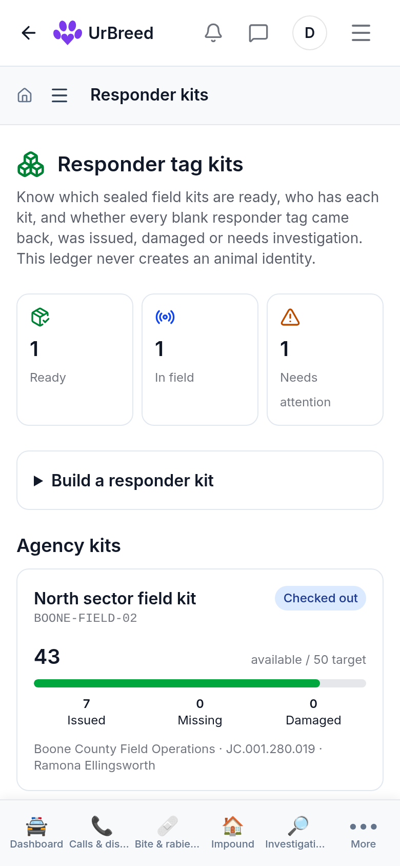
    Mobile responder-kit readiness screen showing accountable animal-control field equipment.
    Live mobile workflow · fictional demonstration data
  2. Step 02

    Reconcile every handoff

    Issue, transfer, return and recount events preserve who handled a kit and when, without replacing the underlying history.
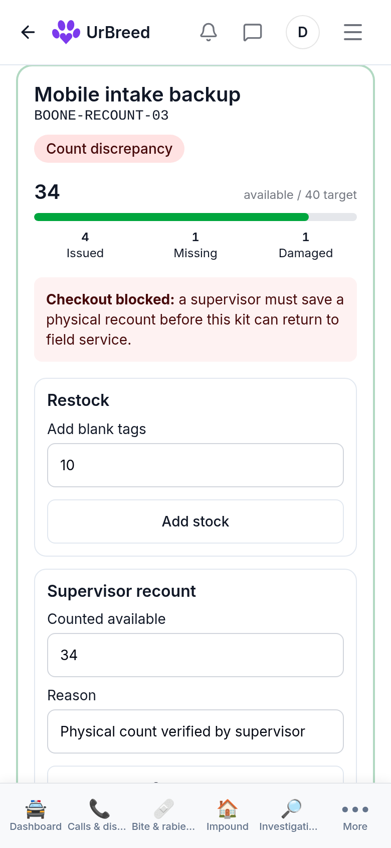
    Mobile responder-kit reconciliation screen with tag counts and custody history.
    Live mobile workflow · fictional demonstration data
  3. Step 03

    Escalate discrepancies for review

    A supervisor recount records the discrepancy and its audit trail so missing equipment becomes visible work, not a silent inventory edit.
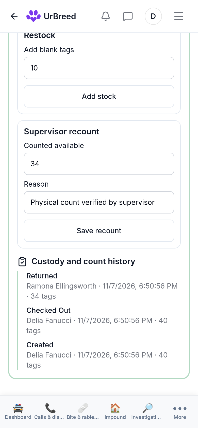
    Mobile supervisor recount screen showing an audited responder-kit discrepancy.
    Live mobile workflow · fictional demonstration data

For residents

Jurisdiction is our problem, not yours. Say what you saw and where; we match the location to the responsible authority where we have one on file.

Report a concern

In progress

Animal running loose, injured animal, a bite, a welfare concern, a deceased animal, wildlife. We match your report to the responsible authority where we have one on file, and tell you how to reach them where we cannot send it ourselves. Coverage is growing area by area.

Lost and found

An animal you found may already be somebody who is looking. That is a different path from an enforcement call and it is kept separate.

Anonymous if you need it

A welfare concern can be reported without an account. People who are afraid of being identified still report, and that is the point.

For officers — what exists today

Being straight about this matters more than a longer list. Signing in gives you the field tools that are actually built.

Scan in the field

Scan a tag or microchip and review existing-record candidates. A scan never auto-links the animal; an officer records the human identity decision and can reverse it without erasing history.

Stray holds

The reclaim clock uses the published, versioned rule for the incident's JC jurisdiction. Missing configuration stops for supervisor review instead of guessing at a legal duration.

Calls and dispatch

Take a call, prioritise it, assign officers and track it to a recorded disposition. Reports sent through urNotify can arrive as calls.

Bites and rabies

Open a bite case and record quarantine, the health-department notification, lab submission and result, and release.

Disposition

A call clears only with how it ended — resolved on scene, returned to owner, impounded, citation issued, referred — as a recorded outcome rather than a closed ticket.

Compliance

Licence and vaccination status for the animals in your jurisdiction.

Intake and custody

Pickup creates a provisional subject. Physical custody can pass to the exact shelter that accepts it without creating a permanent animal ID or a duplicate record.

Evidence and field context

Photo and video evidence stays on an audited incident timeline. LABRIE terrain, weather and access context is attached as an append-only snapshot for the officer and supervisor.

Deliberately deferred integrations

These interfaces are outside the first working journey and remain disabled until they have a registry entry, an agency agreement and their own security review.

CAD, RMS and courts

Planned

No connector is enabled yet. The incident outbox provides the controlled integration seam when an agency approves one.

Public health and disaster command

Planned

These wider command workflows remain separate from the initial resident-report-to-shelter journey.